Following Lorna Doone in Exmoor: A Literary Heritage Trail
A practical guide to the Exmoor places behind R. D. Blackmore's Lorna Doone, from Badgworthy Water to Oare...

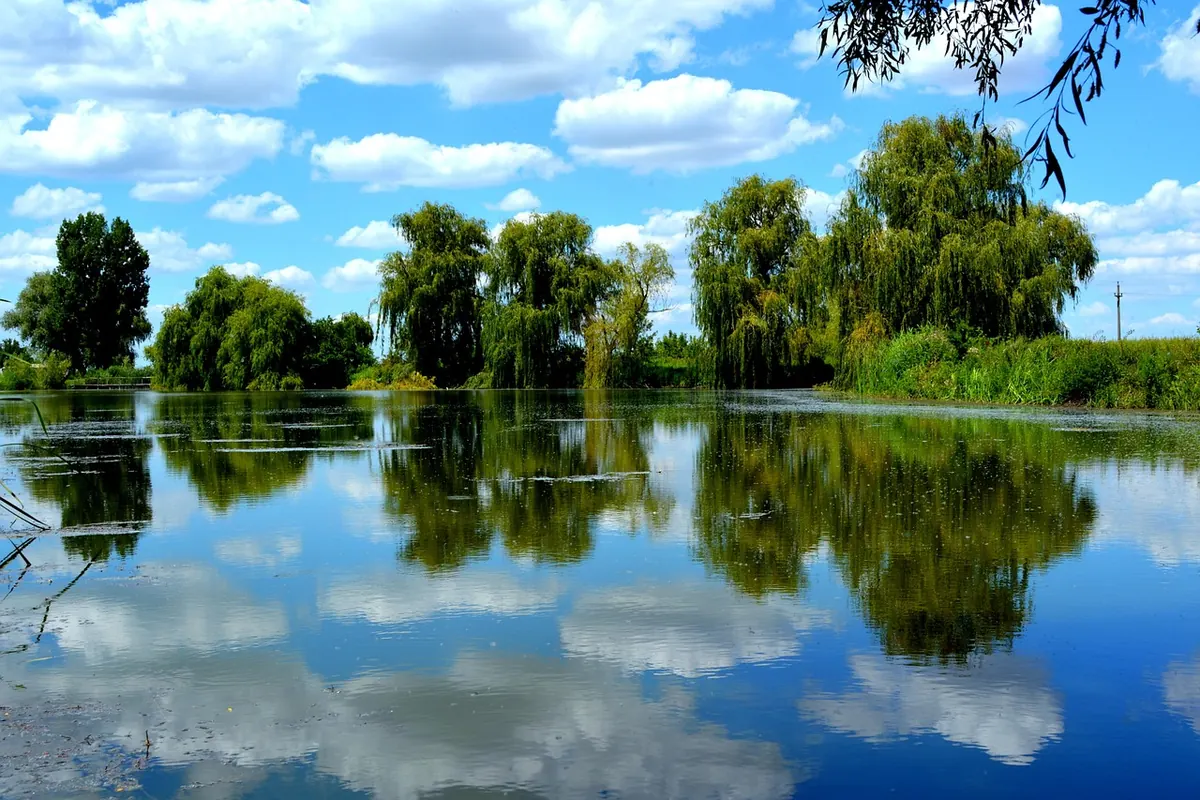
The Somerset Levels look empty from a car window. Flat fields, a line of willows, a ditch catching the light. Walk them and the emptiness starts to explain itself. Almost every field boundary, straight rhyne and clump of willow was put there by somebody, and usually for one of three reasons: fuel, baskets, or getting water off the land.
Peat cutting, willow growing and drainage shaped this landscape over centuries. Two of those trades have all but gone, but their fingerprints are everywhere once you know what to look for.
The Levels sit in a shallow basin between the Mendips, the Quantocks and the Polden Hills. In waterlogged hollows, dead reeds, sedges and mosses never fully rotted. They piled up, season after season, into peat — a soft, dark, spongy ground that can run several metres deep in places. It forms slowly. A metre of it may represent a very long stretch of time.
For most of its history, that peat was cut for fuel. Turf was sliced out by hand with a peat spade, laid on the ground to dry, turned, then stacked and carted home. Wealthier households and institutions held rights over the best moors; commoners had turf rights of their own, which is why old parish boundaries on the Levels can look so tangled. Glastonbury Abbey's moors were worked on an industrial scale for a monastery, with the peat going to the abbey kitchens, brewhouses and the town.
In the twentieth century the same ground was stripped mechanically, this time mostly for horticultural compost and fuel sold in bags. The big workings have since wound down as conservation bodies bought site after site and turned them back into reedbed, fen and wet woodland.
One consequence of all that cutting and draining is worth knowing. Drained peat shrinks and oxidises, so the land surface actually falls. Ground that was already low gets lower, and the pumps and sluices have to work harder to keep it dry. It is one of the quieter arguments for keeping peatland wet.
A turbary is simply a place where peat was cut, and they are not hard to spot if you know the shapes to expect.
Peat is also a superb preservative. Prehistoric wooden trackways, dugout canoes and worked timbers have come out of the Levels because the waterlogged peat kept oxygen away from them. The most famous is the Sweet Track on what is now Shapwick Heath, a timber walkway built across a wet hollow roughly six thousand years ago. Its course is marked and explained on the reserve.
"Withy" is the old word for willow, and withy beds are still a working crop in the villages either side of the Parrett and the Brue — Stoke St Gregory, Burrowbridge, Curload, Athelney, North Curry and their neighbours.
Beds are planted with cuttings and cut on a short rotation, often every one to three years. What you get is a bundle of long, flexible rods. Growers sort them three ways: brown willow, left with its bark on; buff, boiled to loosen the bark and then peeled; and white, peeled without boiling and dried pale. Each behaves differently in the hand, and each suits different work.
The old uses were astonishingly varied: laundry baskets and hampers for the London markets, eel traps, conical fish traps used in the Severn estuary, thatching spars, panniers, cribs and cradles, even willow charcoal for artists. Then plastic, imports and changing fashions knocked the trade sideways, as they did to so many rural crafts.
The trade did not vanish. A handful of yards and craftspeople still cut and weave withy on the Levels, and several beds are managed with an eye on both craft and wildlife. If you walk past a withy bed, treat it as a crop rather than a view: a tangle of stems is someone's year of work, so use the footpath and shut the gate.
Two words unlock the Levels for a walker. A rhyne is a drainage ditch, and a drove is a raised track. Between them they tell you almost everything about how the moors were farmed: wet fields divided by water, dry routes between them.
Traditionally the moors took summer grazing and winter flooding. Villagers moved stock onto the higher ground and let the water back in. From the eighteenth century onwards, straight embanked rivers, cuts and drains tipped the balance towards year-round farming — the Brue, the Axe, the Parrett, the King's Sedgemoor Drain, and the Huntspill River, which was cut in the last century. Pumping stations and sluice gates became part of the scenery, tin-roofed and unbothered by their own oddness.
Look up as you cross these rivers: in many places the water runs above the level of the fields beside it, held in by banks, so a boat on the far side can appear to be sailing along the top of a hedge.
The Levels reward preparation more than most places, because the walking is flat but the ground is not dry.
A practical guide to the Exmoor places behind R. D. Blackmore's Lorna Doone, from Badgworthy Water to Oare...
A three-hour plan for Wells Cathedral's highlights, from the west front to the chapter house, plus...
A step-by-step walking route through Dunster's castle, Yarn Market, watermill and old streets, with the...