Wells Cathedral in Half a Day: A First-Timer's Itinerary and Etiquette Guide
A three-hour plan for Wells Cathedral's highlights, from the west front to the chapter house, plus...

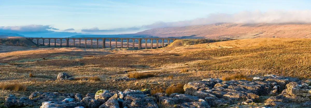
Some literary landscapes disappoint in person. The Doone country does not. Walk up Badgworthy Water after rain, with the stream loud in the combe and the woods dripping overhead, and you can see exactly what R. D. Blackmore was doing when he put a clan of outlaws at the top of it.
Lorna Doone appeared in 1869 and has rarely been out of print since: a long, talkative romance set on Exmoor in the 1670s and 1680s and narrated by a farmer's son, John Ridd. Its hold on the area is still visible on the ground, in footpath signs, farm names and the steady trickle of people who arrive at a small church near Oare because of a wedding that goes badly wrong.
What follows is a trail rather than a single walk — a loose loop of valleys, hamlets and viewpoints between Malmsmead, Oare and the East Lyn. You can drive most of it in an afternoon, but the places that matter are at the end of footpaths, so give it two days at least and carry a map.
Blackmore did not invent Exmoor's outlaws from nothing. In the valley of Badgworthy Water lie the earthworks of a deserted settlement — low walls, house platforms and worn trackways that local people had long linked with rough company. The novel gave those ruins a story, and readers have been walking to them ever since.
Blackmore himself knew the West Country from the inside. He boarded at Blundell's in Tiverton and came to know the moor on foot as a boy, long before he settled into a London suburb and wrote the book from memory and from other people's books. The result is a landscape that is true in spirit rather than in survey. He moves hills about, invents a waterfall or two, and gives the Ridds a farm that owes more to a reader's idea of a farm than to any deeds office. None of that matters on the ground. What he got right was the weather, the mud, the isolation, and the way a valley can feel like a room with only one door.
The book itself is stranger than its reputation suggests. It digresses into farming, weather, cider and local gossip; it turns serious when the Monmouth rebellion and Judge Jeffreys arrive in the later chapters. It also took its time to find an audience, selling modestly at first and then steadily, until by the end of the nineteenth century it had become one of those novels that households simply had on the shelf. You do not need to have finished it to enjoy the trail, though a second-hand paperback in your bag makes the valley considerably richer.
The usual approach is from Malmsmead, where a narrow lane crosses a packhorse bridge and a small car park fills early on fine days. From there, a path follows Badgworthy Water upstream, climbing gently between beech hangers and open moor. After roughly two miles the valley narrows and the ruins appear on the left bank — modest, grassy, easy to walk past if you are not looking. This is the place readers have mapped onto the Doones' hidden village.
The walking is not difficult, but it is rarely dry. The path takes water after heavy rain, and the last stretch through the combe can be genuinely boggy in winter. Allow three hours for the return trip, more if you are stopping to read passages aloud, and expect to share the narrower sections with sheep, ponies and the occasional herd of Exmoor cattle.
Do not climb on the walls. They are archaeological remains rather than scenery, and they erode quickly under boots. Stand back, look at the lie of the land, and the sense of a place hard to reach and easy to defend explains itself.
Downstream, near Oareford, a small mossy bridge crosses Weir Water. It carries the name Robber's Bridge and a reputation for ambushes, and it sits at a junction of lanes that feel genuinely old — packhorse routes, not modern shortcuts. Cloud Farm, a little further up the valley, is the customary base for campers and the last place to fill a water bottle before the climb.
Oare is a handful of houses and a church, reached by lanes that rise steeply from the East Lyn valley. The church of St Mary the Virgin is the setting for the novel's most famous moment, when Lorna is shot on her wedding day. It is a plain, quiet building, and that plainness makes the scene feel more possible rather than less. Look for the small details that locals point out — the narrow doorway, the worn floor, the sense of a room that has heard a great deal and said very little.
Above the hamlet, the lane runs towards Plovers' Barrow, the farm Blackmore gave to John Ridd's family, and on over the moor. The road up from Oareford is steep and single-track. If you meet a car coming the other way, one of you will be reversing; do it calmly and use gateways rather than verges.
Readers have long associated the novel's wooded "Glen" with the East Lyn valley, where the river runs through a deep, damp gorge below Watersmeet and the hills above Lynmouth. Whether or not Blackmore had this exact stretch in mind, the mood fits: dark water, overhanging trees, and a path that keeps disappearing round another bend.
The twin towns themselves are worth an afternoon. The cliff railway between them is a piece of Victorian engineering, and the Valley of Rocks, a short walk west of Lynton, is one of the strangest coastal landscapes in southern England. It belongs to a different story, but the same moor. Lynmouth also carries the memory of the flood of 1952, when the river came down in the night and took houses and bridges with it; the memorials are a reminder that this gentle-looking water can turn very quickly.
The pleasure of the trail is in matching the book to the ground, and the honest answer is that the match is partial. Some places are certain — the ruins, Oare church, the Oareford lanes. Others are suggestions, and Blackmore was happy to leave them that way. A few habits will make the whole thing more rewarding:
The valley does not read like a setting. It reads like somewhere people once had good reason to hide.
Late spring and early autumn are the best of it: bluebells and new beech in May, bracken turning bronze in September, and fewer cars on the single-track lanes. High summer brings the crowds to Malmsmead and Watersmeet, along with midges in the wooded sections — take repellent. Winter walking here is possible and often beautiful, but the moor roads can ice over and the valley paths flood.
Boots are essential rather than advisable, and waterproofs belong in the bag whatever the forecast says, because Exmoor weather changes faster than the map suggests. Dogs are welcome on most of the route but must be under control on farmland and near livestock. Park considerately: verges are soft, gateways are working entrances, and the lanes are used by tractors as well as visitors.
Finish, if you can, with a slow evening in Lynmouth or Dulverton and the book open on the table. The trail does not need a pilgrimage mentality. It needs a pair of boots, a bit of patience with the lanes, and the willingness to stand still at the top of a combe while the water goes on making the same noise it made three hundred years ago.
Photo: TimHill / Pixabay
A three-hour plan for Wells Cathedral's highlights, from the west front to the chapter house, plus...
A step-by-step walking route through Dunster's castle, Yarn Market, watermill and old streets, with the...
A warm, practical introduction to Somerset cider: how orchards shaped the county, how the press and the...